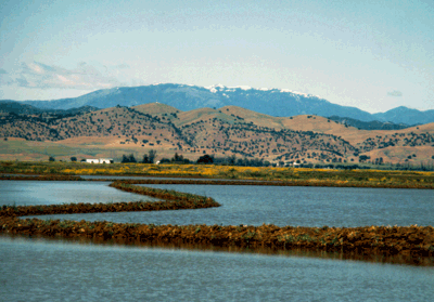
Figure 8 - Willows soils
flooded for rice production with the Coast Range in the background.
104—Willows silty clay, 0 to 1 percent slopes, frequently flooded
Map Unit Setting
General location:
Lowest elevation areas of the Colusa Basin and Butte sink
MLRA: 17
Mapunit geomorphic setting: Basin floor
Elevation: 35 to 110 feet (12 to 35
meters)
Mean annual precipitation: 14 to 16
inches (355 to 405 millimeters)
Mean annual air temperature: 61 to 63
degrees F. (16 to 17 degrees C.)
Frost-free period: 225 to 250 days
Willows silty clay, frequently flooded—90 percent
Minor components: 10 percent
Major Component Description
Willows silty clay, frequently flooded
Component geomorphic setting:
Basin floor
Parent material: Alluvium
Typical vegetation: Irrigated cropland
Figure 8 - Willows soils
flooded for rice production with the Coast Range in the background.
Component Properties and Qualities
Slope:
0 to 1 percent
Runoff: Very low
Surface features: None noted.
Percent area covered by surface coarse fragments:
None noted.
Depth to restrictive feature: None
noted
Slowest permeability class: Very slow
Salinity: Saline within 40 inches
Sodicity: Sodic within 40 inches
Available water capacity: About 8.9
inches (High)
Component Hydrologic Properties
Present flooding:
Frequent
Present ponding: None
Current water table: Present
Natural drainage class: Poorly drained
Altered hydrology: Flood control
structures on the Sacramento River have changed flooding frequency and duration
and lowered water tables. Rice drainage ditches have lowered water tables.
Accumulation of salts at the surface may have been removed through reclamation
efforts or ponding for rice production. Willows soil in this map unit is
frequently flooded for long duration.
Interpretive Groups
Land capability irrigated:
4w-2
Land capability nonirrigated: 4w-2
Typical Profile
Ap1—0 to 5 inches; silty clay
Ap2—5 to 13 inches; silty clay
Bw—13 to 20 inches; silty clay
Bssy1—20 to 39 inches; silty clay
Bssy2—39 to 51 inches; silty clay
Bssy3—51 to 59 inches; silty clay
Bssy4—59 to 72 inches; clay
Bssy5—72 to 80 inches; silty clay
Bkssy—80 to 87 inches; clay
Estimated Minor Components
Capay clay loam, frequently flooded and similar soils
Composition:
0 to 5 percent
Slope: 0 to 1 percent
Component geomorphic setting: Basin
floor
Unnamed
Composition:
0 to 2 percent
Slope: 0 to 1 percent
Component geomorphic setting: Channel
Willows silty clay, occasionally flooded and similar soils
Composition:
0 to 2 percent
Slope: 0 to 1 percent
Component geomorphic setting: Basin
floor
Scribner silt loam, frequently flooded and similar soils
Composition:
0 to 1 percent
Slope: 0 to 1 percent
Component geomorphic setting: Flood
plain
Additional Component Properties
See "Chemical Properties of Soils" table and the "Physical Properties of Soils" table for component horizon data.
For additional component horizon data, see the "Soil Properties" section of this publication.
A typical soil description with range in characteristics is included, in alphabetical order in the "Classification of the Soils" section.
Use and Management
Major uses:
Irrigated crops
For information about management, see the "Use and Management" section
of this publication.